

Key Takeaways
- Navigation apps are powerful but fail without cellular signal, which is common in rural and remote areas.
- Paper maps never lose signal but go out of date and cannot reroute around road closures or traffic.
- Offline GPS devices work without cell service but rely on map downloads that must be updated manually.
- No single navigation tool covers every scenario — most experienced road trippers use a combination.
Our Verdict
Each navigation tool fills a different gap. Navigation apps excel on well-connected urban and suburban routes, offline GPS devices handle remote terrain reliably, and paper maps provide a dependable backup when technology fails. Choosing one at the expense of the others is where most drivers run into trouble.
| Best for | Recommended |
|---|---|
| City driving and connected highways with real-time traffic | Navigation Apps |
| Remote or rural driving with no cell coverage | Offline GPS Device |
| Backup orientation and big-picture route planning | Paper Maps |
| Cross-country trips spanning multiple coverage zones | Combination of all three |
Why Navigation Tools Still Let Drivers Down
Smartphone navigation has made road trips easier in many ways — turn-by-turn directions, live traffic updates, and instant rerouting have become standard expectations. But ask any driver who has stared at a spinning loading icon on a mountain pass, or missed a turn because their paper map showed a road that no longer exists, and a clear truth emerges: every navigation tool has a condition where it stops working well.
Understanding those failure points before you leave — not after you're already lost — is a core part of planning a road trip route that actually holds together under real conditions. This comparison breaks down where each option genuinely fails, so you can prepare accordingly.
| Navigation Apps | Paper Maps | Offline GPS Device | |
|---|---|---|---|
| Works without cell signal | No (unless offline maps downloaded) | Yes | Yes |
| Real-time traffic updates | Yes, when connected | No | No |
| Automatic rerouting | Yes, when connected | No | Limited |
| Map currency | Updated continuously online | Fixed at print date | Requires manual software update |
| Requires power/battery | Yes — phone battery | No | Yes — car power port |
| Useful at international borders | Only with local data plan | Yes | With correct regional maps |
| Big-picture route overview | Limited on small screen | Excellent | Moderate |
Navigation Apps: Powerful Until You Lose the Signal
Apps like Google Maps and Apple Maps are built around a live data connection. Real-time traffic, road closure alerts, and rerouting all depend on cellular service. The moment you drive into a dead zone — common across the American West, rural Appalachia, and most stretches between small towns — the app either freezes, defaults to a cached version of the route, or loses your position entirely.
Most apps offer downloadable offline maps, which help, but these are typically limited to preset geographic tiles and do not carry live traffic or updated road conditions. They also consume significant storage space on your phone, and they expire if not refreshed regularly.
Border crossings add another wrinkle: roaming charges or the absence of a local data plan can render a navigation app functionally useless as soon as you cross into another country. Always verify data coverage with your carrier before driving internationally.
Download Offline Maps Before You Leave Home
Most navigation apps allow you to download specific regions for offline use while on Wi-Fi. Do this a day before your trip, not in the driveway before departure. Offline maps can be several gigabytes in size and may take time to download fully. Check that the downloaded area covers your entire route, not just your starting region.
Paper Maps: Reliable But Frozen in Time
A paper road atlas or state highway map has real strengths: it works without power, signal, or a charged battery. It gives you a complete, at-a-glance picture of an entire region that no phone screen can match. For understanding the big shape of a route — where the mountain ranges are, which highways run parallel, how far it is to the next sizable town — a paper map is hard to beat.
Its core failure is that it cannot update. Road construction, seasonal closures, new bypasses, and changed speed limits will not appear on a map printed two or three years ago. In areas undergoing rapid infrastructure change or post-disaster road damage, an outdated map can send you confidently toward a road that is closed or washed out.
Paper maps also require the driver (or a navigator in the passenger seat) to track position manually, which is genuinely difficult at highway speed and practically impossible when driving alone. For back roads and scenic detours, where landmarks matter more than mile markers, this limitation becomes especially pronounced.
Offline GPS Devices: Dependable, but Only as Current as Your Last Update
Standalone GPS units — the kind you mount on a windshield — use satellite signals rather than cellular data, which means they work reliably in remote areas where your phone cannot. This makes them a genuine asset for national park drives, backcountry routes, and long stretches of highway with no cell towers.
Their limitation mirrors the paper map's in one key way: they are only as accurate as their installed maps. Many drivers purchase a GPS device, use it for years, and never run the required software update. Roads change; the device does not know. When the map data is stale, the device confidently navigates toward roads that have been rerouted, renamed, or closed.
Battery life is rarely an issue since these devices plug into the car's power port, but the units themselves are an added cost and an added item to pack and manage. For context on what to bring versus leave behind, see our look at common road trip packing mistakes.
~70%
U.S. land area with limited cell coverage
According to FCC coverage data analyses, a substantial share of rural U.S. geography falls outside reliable 4G LTE coverage, affecting navigation app reliability.
1 in 3
Drivers who keep a paper map in the car
Surveys by automotive and travel organizations have consistently found paper map ownership declining, leaving many drivers with no backup when digital tools fail.
Building a Navigation Strategy That Actually Works
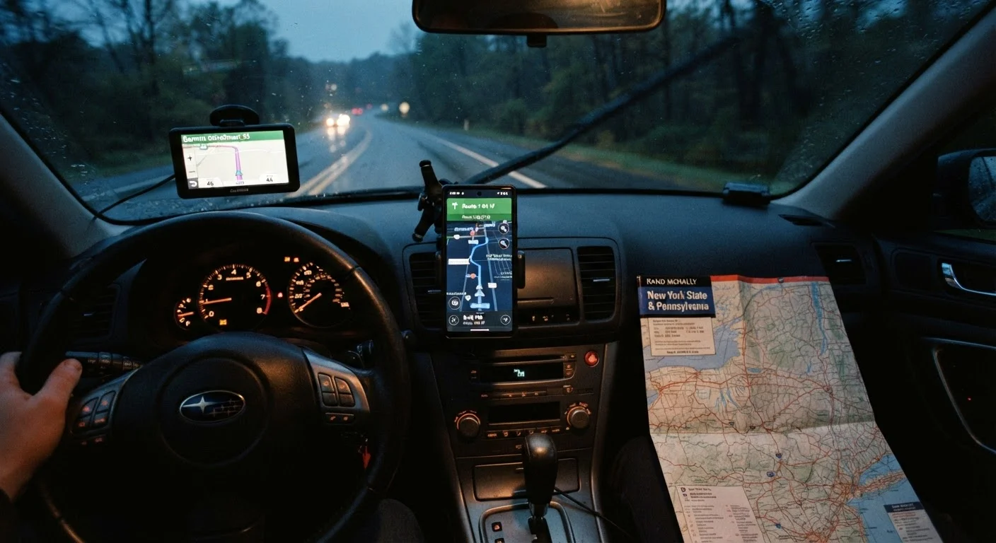
The most reliable approach for longer road trips — especially those crossing rural or remote areas — is layering tools rather than committing to one. Use a navigation app as your primary guide on connected roads, download the relevant offline maps before you leave home, and keep a current paper atlas in the car as a structural backup. If your route takes you through extended dead zones, a dedicated GPS device with updated maps adds meaningful redundancy.
Before any trip involving unfamiliar territory, research your destination through reliable sources to identify known coverage gaps, seasonal road conditions, and any areas where official advisories apply. Road conditions in remote areas can change with little notice, and no navigation tool substitutes for current, verified information before you depart.
The goal is not to carry every tool possible — it is to understand which tool fails first in the terrain you are actually driving through, and to have the next layer ready when it does.