

Key Takeaways
- Many of the Southwest's most historically rich towns sit just off major highways, requiring only brief detours.
- Small towns like Marfa, Jerome, and Taos Pueblo offer cultural depth that crowded tourist corridors often lack.
- Visiting off-peak seasons and checking local event calendars can significantly improve the experience.
- Cell service and fuel availability can be limited in remote areas — plan accordingly before leaving main roads.
- Some sites, including Indigenous sacred sites, require advance permits or have restricted visitor access.
Why Small Towns Reward the Curious Road-Tripper
The American Southwest is most famous for its grand national parks and canyon overlooks, but the towns scattered between those landmarks often tell the fuller story. Mining booms and busts, Indigenous history stretching back thousands of years, Spanish colonial architecture, and Cold War-era quirks — all of it surfaces when you're willing to take the exit ramp rather than stay on the interstate.
These detours don't have to be lengthy. Many of the towns below sit within 10 to 30 miles of well-traveled routes through Arizona, New Mexico, Utah, and Texas. A good route plan makes these stops feel purposeful rather than impulsive — see how to plan a road trip with worthwhile stops built in for practical guidance. Before you go, verify current road conditions, facility hours, and any entry requirements through official local or state tourism sources, as these can change seasonally.
Marfa, Texas
Marfa sits in the high Chihuahuan Desert of far West Texas, roughly 60 miles south of I-10. It began as a railroad water stop in the 1880s and later became an Army base and then a ranching hub. Since the 1970s, when minimalist artist Donald Judd relocated there and began an ambitious permanent installation project, it has developed an unlikely identity as an arts destination in one of the most remote parts of the lower 48 states.
The Chinati Foundation preserves large-scale works spread across the grounds of a former military base — visiting requires a scheduled tour, so check availability before arriving. Beyond the arts, Marfa has an authentic downtown with a working courthouse square, and the surrounding landscape of grassland and mountain ranges is genuinely striking. The so-called Marfa Lights — unexplained glowing orbs seen on the plain east of town — have been drawing curious visitors for generations, and a dedicated viewing area off US-67 makes the experience easy to access on a clear night.
Marfa's minimalist art scene thrives in one of the most remote corners of the continental United States.
Jerome, Arizona
Clinging to the side of Mingus Mountain above the Verde Valley, Jerome was once one of the largest copper-mining towns in the territory that would become Arizona. At its peak in the early 20th century, the population exceeded 15,000. When the mines closed in 1953, Jerome became a near-ghost town. Artists and writers moved in during the 1960s and 1970s, and the town has evolved into a small community of galleries, historic buildings, and a genuinely steep Main Street where the old mine tailings and equipment are still visible.
The Jerome State Historic Park, housed in a 1916 mansion that once belonged to a mining magnate, provides strong context for the boom-and-bust story. From Jerome's vantage, you can see the Verde Valley spread out below — on clear days, the view extends toward Sedona's red rock formations. Jerome pairs naturally with a stop in Prescott or Cottonwood, both within 30 miles, making it a reasonable anchor for a day loop off AZ-89A.
Jerome's dramatic hillside setting makes it one of the most visually striking former mining towns in Arizona.
Taos, New Mexico — Beyond the Ski Valley
Most people associate Taos with its ski resort, but the town's deeper draw is its layered cultural history. Taos Pueblo — a UNESCO World Heritage Site and continuously inhabited community for over a thousand years — sits just north of the town plaza. Access is managed by the Taos Pueblo people; entry fees and photography policies apply, and certain areas and events are restricted out of respect for the community. Always check the Pueblo's current visitor guidelines before arriving, as hours and access rules can change.
The historic plaza itself reflects the confluence of Pueblo, Spanish colonial, and Anglo-American influences that define northern New Mexico. The Millicent Rogers Museum holds an exceptional collection of Southwestern jewelry, textiles, and pottery. Taos also sits at the edge of the Rio Grande del Norte National Monument, where a gorge of volcanic basalt drops dramatically into the landscape — one of the more surprising geological features in the region and accessible via a short drive west of town.
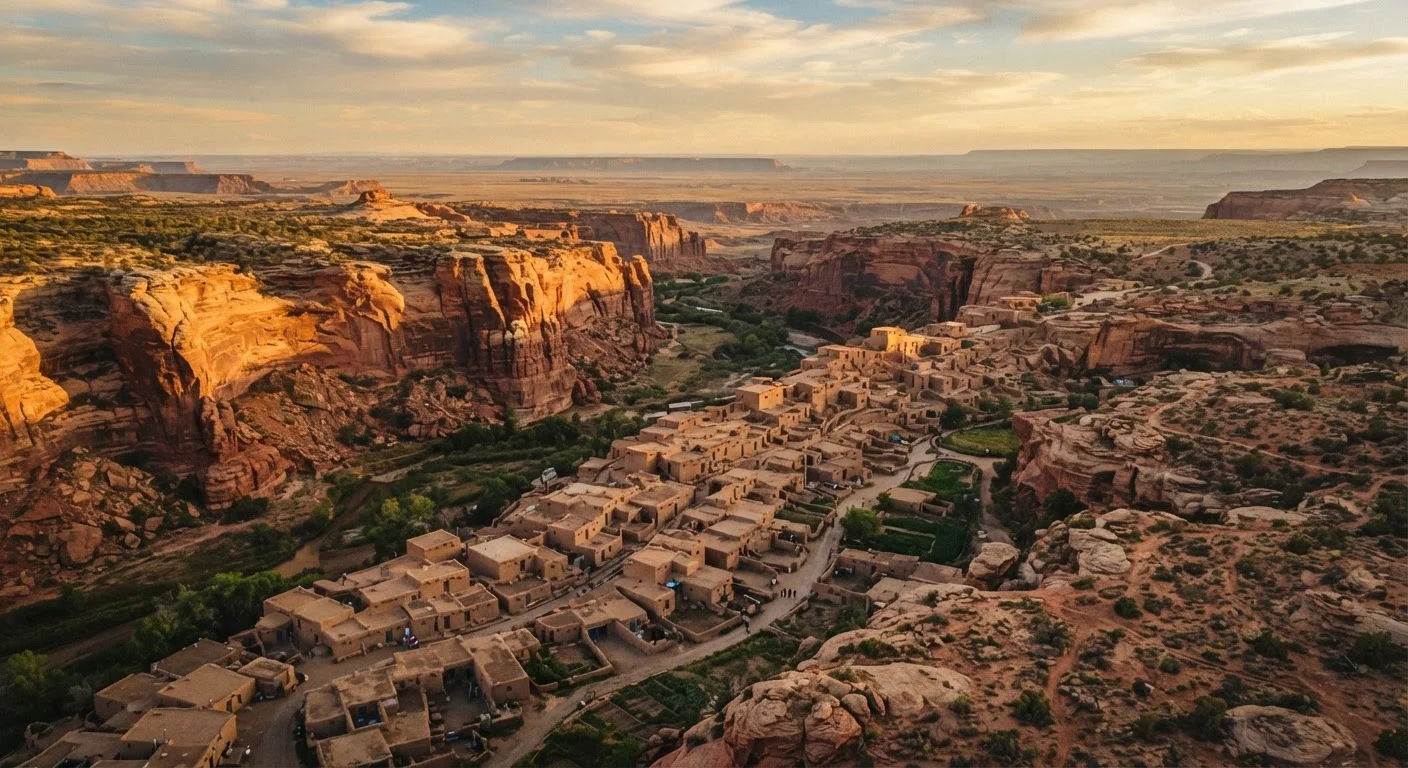
Taos Pueblo has been continuously inhabited for over a thousand years and remains an active, living community today.
Chloride, New Mexico
Not to be confused with Chloride, Arizona, this tiny New Mexico community in the Black Range mountains of Sierra County was once a silver-mining settlement. Today its permanent population numbers in the dozens, and the town has a quietly eccentric character built around a handful of preserved buildings, murals painted on the old storefronts by a local artist, and a genuine sense that the modern world hasn't fully arrived.
Chloride is roughly 15 miles off US-52 and makes an interesting stop for travelers on the Geronimo Trail National Scenic Byway. The surrounding Gila National Forest offers serious hiking, including access to the Gila Wilderness — the country's first designated wilderness area. The combination of ghost town atmosphere and accessible backcountry is unusual. Fuel and services are not available in Chloride itself, so plan accordingly before leaving Truth or Consequences or Hillsboro.
Chloride sits near the country's first designated wilderness area, making it a rare blend of history and backcountry access.
Moab, Utah's Quieter Neighbor: Monticello
Moab draws enormous crowds as a gateway to Arches and Canyonlands national parks, and the pressure on the town shows. About 50 miles south on US-191, Monticello sits at 7,000 feet elevation at the edge of the Abajo Mountains and sees a fraction of the visitor traffic. It provides a more workable base for exploring the Needles District of Canyonlands — generally considered the park's most rewarding backcountry area — without the competition for campsites and trailhead parking that plagues Moab.
Monticello itself is a small ranching community with a modest downtown and a county museum covering the history of San Juan County, including its complex Indigenous, Spanish, and settler heritage. The Abajo Mountains provide opportunities for dispersed camping and forest roads passable by high-clearance vehicles. For those building a longer Southwest loop, Monticello connects naturally with Monument Valley to the south and the Bears Ears National Monument landscape to the east — though visitors should verify current access conditions for Bears Ears directly with the Bureau of Land Management before setting out.
Monticello offers a quieter alternative to Moab with direct access to Canyonlands' most rewarding backcountry district.
Silver City, New Mexico
Silver City occupies an interesting position in New Mexico's travel landscape: substantial enough to have a functioning arts scene, restaurants, and lodging infrastructure, yet small enough (population around 10,000) to feel genuinely uncrowded. It was founded as a silver-mining town in 1870 and is best known outside New Mexico as the childhood home of Billy the Kid, though the historic and cultural layers here run deeper than any single legend.
The town's Victorian-era brick downtown survived a flood in 1895 that carved a 50-foot-deep channel through Main Street — an event locals still call The Ditch. That channel, now called the Big Ditch Park, runs through the center of town as a small green corridor. Silver City is also the primary gateway to the Gila Cliff Dwellings National Monument, a 44-mile drive north through mountainous terrain. The cliff dwellings, occupied by the Mogollon people around the late 13th century, are modest in scale but remarkably well-preserved, and the surrounding hot springs and wilderness trails extend the visit naturally into a full day or overnight trip.
Silver City's flood-carved downtown and proximity to the Gila Cliff Dwellings make it one of New Mexico's most layered stops.
Making the Most of Your Detour
A few habits make small-town stops more rewarding and less stressful. Top off your fuel tank before heading into rural stretches — gas stations can be 40 or more miles apart in parts of the region. Download offline maps in advance, since cell coverage drops abruptly in canyon country. And carry more water than you think you need; even a short walk in high desert heat demands it.
Check Access Before You Go
Several Southwest small towns are adjacent to or within Indigenous territories, national monuments, or wilderness areas that have specific permit requirements, seasonal closures, or photography restrictions. Always verify current conditions through official tribal, National Park Service, or Bureau of Land Management sources before your visit. Building flexibility into your schedule — rather than a rigid day-by-day plan — makes it easier to adapt when access turns out to be limited.
For travelers drawn to landscape as much as culture, note that many of these towns are excellent staging points for nearby public lands. However, the towns themselves often hold as much interest as the scenery around them — don't rush through to reach the trailhead. If this kind of layered discovery appeals to you, what first-time national park visitors often overlook applies equally well to small-town exploration: slow down, look for what isn't labeled, and talk to locals when possible.
The Southwest's small towns reward patience. The ones listed here are starting points, not a comprehensive map — and that's the point. The best detour is often the one you find yourself.